దస్త్రం:Aerial photo of the Andes.jpg
ఈ మునుజూపు పరిమాణం: 484 × 599 పిక్సెళ్ళు. ఇతర రిజల్యూషన్లు: 194 × 240 పిక్సెళ్ళు | 387 × 480 పిక్సెళ్ళు | 620 × 768 పిక్సెళ్ళు | 1,048 × 1,298 పిక్సెళ్ళు.
అసలు దస్త్రం (1,048 × 1,298 పిక్సెళ్ళు, ఫైలు పరిమాణం: 1,007 KB, MIME రకం: image/jpeg)
This is a file from the Wikimedia Commons. Information from its description page there is shown below. Commons is a freely licensed media file repository. You can help. |
సారాంశం
| వివరణ |
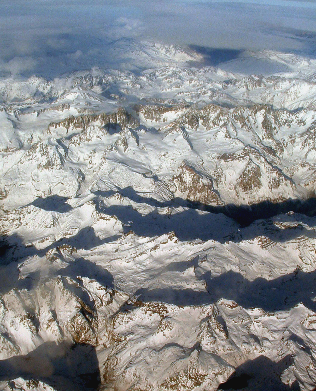
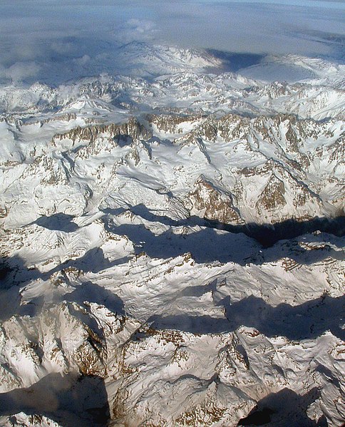
English: The Andes. Photo was taken on a flight between Asuncion, Paraguay and Santiago, Chile, so the exact location is probably in the area between Santiago, Chile and Cordoba, Argentina. |
| తేదీ | |
| మూలం | Wikipedia:Contact us/Photo submission |
| కర్త | Robert Morrow |
| అనుమతి (ఈ దస్త్రాన్ని పునర్వినియోగించుకోవడం) |
ఈ దస్త్రం క్రియేటివ్ కామన్స్ Attribution-Share Alike 3.0 Unported లైసెన్సు క్రింద లభ్యం.
|
| ఇతర కూర్పులు | Derivative works of this file: Palomo.jpg |
| Object location | | View this and other nearby images on: OpenStreetMap |
|---|
| Annotations | This image is annotated: View the annotations at Commons |
ఫైలు చరితం
తేదీ/సమయం ను నొక్కి ఆ సమయాన ఫైలు ఎలా ఉండేదో చూడవచ్చు.
| తేదీ/సమయం | నఖచిత్రం | కొలతలు | వాడుకరి | వ్యాఖ్య | |
|---|---|---|---|---|---|
| ప్రస్తుత | 23:01, 6 నవంబరు 2008 | | 1,048 × 1,298 (1,007 KB) | Holly Cheng | {{Information |Description={{en|1=The Andes}} |Source={{w|Wikipedia:Contact us/Photo submission}} |Author=Robert Morrow |Date=see EXIF info |Permission={{PermissionOTRS|ticket=https://secure.wikimedia.org/otrs/index.pl?Action=AgentTicketZoom&TicketID=2170 |
లింకులు
కింది పేజీలలో ఈ ఫైలుకు లింకులు ఉన్నాయి:
సార్వత్రిక ఫైలు వాడుక
ఈ దస్త్రాన్ని ఈ క్రింది ఇతర వికీలు ఉపయోగిస్తున్నాయి:
- ami.wikipedia.org లో వాడుక
- ar.wikipedia.org లో వాడుక
- arz.wikipedia.org లో వాడుక
- as.wikipedia.org లో వాడుక
- bh.wikipedia.org లో వాడుక
- bs.wikipedia.org లో వాడుక
- bxr.wikipedia.org లో వాడుక
- ca.wikipedia.org లో వాడుక
- ceb.wikipedia.org లో వాడుక
- de.wikipedia.org లో వాడుక
- dty.wikipedia.org లో వాడుక
- en.wikipedia.org లో వాడుక
- en.wikibooks.org లో వాడుక
- eo.wikipedia.org లో వాడుక
- es.wikipedia.org లో వాడుక
- fiu-vro.wikipedia.org లో వాడుక
- hy.wikipedia.org లో వాడుక
- ilo.wikipedia.org లో వాడుక
- Andes
- Kabambantayan
- Wikipedia:Napili nga artikulo ita nga aldaw/Marso 26
- Wikipedia:Napili nga artikulo ita nga aldaw/Mayo 10
- Wikipedia:Napili nga artikulo ita nga aldaw/Hunio 24
- Wikipedia:Napili nga artikulo ita nga aldaw/Agosto 8
- Wikipedia:Napili nga artikulo ita nga aldaw/Septiembre 22
- Wikipedia:Napili nga artikulo ita nga aldaw/Nobiembre 6
- Wikipedia:Napili nga artikulo ita nga aldaw/Disiembre 21
- Wikipedia:Napili nga artikulo ita nga aldaw/Pebrero 4
- io.wikipedia.org లో వాడుక
- ka.wikipedia.org లో వాడుక
- kk.wikipedia.org లో వాడుక
- ko.wikipedia.org లో వాడుక
- lld.wikipedia.org లో వాడుక
- mai.wikipedia.org లో వాడుక
- ml.wikipedia.org లో వాడుక
- mni.wikipedia.org లో వాడుక
- mr.wikipedia.org లో వాడుక
- my.wikipedia.org లో వాడుక
ఈ దస్త్రపు మరింత సార్వత్రిక వాడుకను చూడండి.