దస్త్రం:Europe countries map en 2.png

ఈ మునుజూపు పరిమాణం: 737 × 599 పిక్సెళ్ళు. ఇతర రిజల్యూషన్లు: 295 × 240 పిక్సెళ్ళు | 590 × 480 పిక్సెళ్ళు | 944 × 768 పిక్సెళ్ళు | 1,259 × 1,024 పిక్సెళ్ళు | 1,473 × 1,198 పిక్సెళ్ళు.
అసలు దస్త్రం (1,473 × 1,198 పిక్సెళ్ళు, ఫైలు పరిమాణం: 1.16 MB, MIME రకం: image/png)
This is a file from the Wikimedia Commons. Information from its description page there is shown below. Commons is a freely licensed media file repository. You can help. |
సారాంశం
| వివరణ |
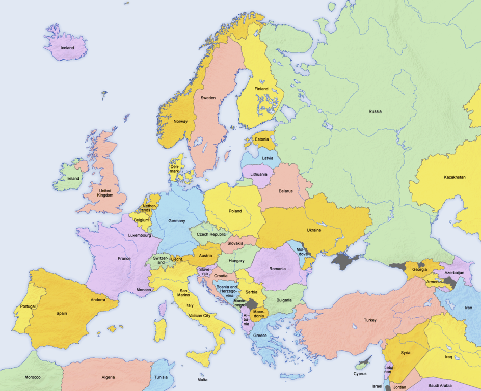
English: Map of countries in Europe and the surrounding region |
||||||||||
| తేదీ | 02.04.2006 | ||||||||||
| మూలం | Derivative work of Europe countries map en.png by San Jose, based on the Generic Mapping Tools and ETOPO2 | ||||||||||
| కర్త | San Jose (map), Hayden120 (retouch) | ||||||||||
| అనుమతి (ఈ దస్త్రాన్ని పునర్వినియోగించుకోవడం) |
|
||||||||||
| ఇతర కూర్పులు |
Derivative works of this file: Kinks International Tour 1969.jpg
[]
|


| This is a retouched picture, which means that it has been digitally altered from its original version. Modifications: Saturation, brightness, contrast. The original can be viewed here: Europe countries map en.png:
|
See also
_en.png)
.png)
.jpg)
ఫైలు చరితం
తేదీ/సమయం ను నొక్కి ఆ సమయాన ఫైలు ఎలా ఉండేదో చూడవచ్చు.
| తేదీ/సమయం | నఖచిత్రం | కొలతలు | వాడుకరి | వ్యాఖ్య | |
|---|---|---|---|---|---|
| ప్రస్తుత | 08:24, 7 అక్టోబరు 2020 | | 1,473 × 1,198 (1.16 MB) | Wiz9999 | Corrected artefacts around polish border that had been introduced earlier. |
| 18:40, 23 ఫిబ్రవరి 2018 |  | 1,473 × 1,198 (1.15 MB) | Wiz9999 | Fixed the colouration artifacts around Crimea, and added the remaining disputed territory around Eastern Europe. See EN:List of states with limited recognition and EN:List of sovereign states and dependent territories in Europe | |
| 22:33, 16 ఫిబ్రవరి 2017 |  | 1,473 × 1,198 (620 KB) | Fixingup | Revert. User warned. | |
| 20:52, 16 ఫిబ్రవరి 2017 |  | 1,473 × 1,198 (456 KB) | Satt 2 | ||
| 05:36, 16 ఫిబ్రవరి 2017 |  | 1,473 × 1,198 (620 KB) | Fixingup | There's already a map like this that has Crimea shown as Ukraine. This one shows it disputed. | |
| 19:31, 15 ఫిబ్రవరి 2017 |  | 1,473 × 1,198 (456 KB) | Satt 2 | ||
| 23:08, 23 అక్టోబరు 2014 |  | 1,473 × 1,198 (620 KB) | Bobby Martnen | The status of the Crimea is disputed - so I changed it to gray to reflect that. | |
| 22:02, 5 మే 2014 |  | 1,473 × 1,198 (456 KB) | Anastan | original image. Create new one for your "reality", not under this name | |
| 16:25, 5 మే 2014 |  | 1,473 × 1,198 (1.24 MB) | Denniss | Reverted to version as of 21:24, 15 January 2014 | |
| 11:01, 5 మే 2014 |  | 1,473 × 1,198 (456 KB) | Tresnjevo | Previous version was neutral. |
లింకులు
కింది పేజీలలో ఈ ఫైలుకు లింకులు ఉన్నాయి:
- అండొర్రా
- అబ్ఖజియా
- అల్బేనియా
- ఆక్రోటిరి, ఢెకెలియా
- ఇటలీ
- ఉక్రెయిన్
- ఉత్తర మేసిడోనియా
- ఎస్టోనియా
- ఐరోపా
- ఐర్లాండ్
- ఐస్లాండ్
- కొసావో
- క్రొఏశియా
- గ్రీస్
- చెక్ రిపబ్లిక్
- జర్మనీ
- జార్జియా (దేశం)
- జెర్సీ
- టర్కీ
- డెన్మార్క్
- నార్వే
- నెదర్లాండ్స్
- పోర్చుగల్
- పోలాండ్
- ఫిన్లాండ్
- ఫ్రాన్సు
- బల్గేరియా
- బెలారస్
- బెల్జియం
- బోస్నియా, హెర్జెగోవినా
- మధ్య ఆఫ్రికా
- మాంటెనెగ్రో
- మాల్టా
- మొనాకో
- మోల్డోవా
- యుగోస్లేవియా
- యునైటెడ్ కింగ్డమ్
- రష్యా
- రొమేనియా
- లక్సెంబర్గ్
- లాట్వియా
- లిథువేనియా
- లైచెన్స్టెయిన్
- వాటికన్ నగరం
- విల్లా మెర్సిడెస్ (లేక్ కోమో)
- సాన్ మారినో
- సార్వభౌమ రాజ్యాల జాబితా
- సెర్బియా
- సైప్రస్
- స్పెయిన్
- స్లొవేకియా
- స్లోవేనియా
- స్విట్జర్లాండ్
- స్వీడన్
- హంగరి
- వాడుకరి:Deepa Kammagani/ప్రయోగశాల
- వాడుకరి:T.sujatha/ప్రయోగశాల
- వాడుకరి:ప్రభాకర్ గౌడ్ నోముల/1
- వికీపీడియా:వికీప్రాజెక్టు/ప్రపంచదేశాలు
- మూస:Template group
- మూస:Template group/doc
- మూస:ఐరోపా
సార్వత్రిక ఫైలు వాడుక
ఈ దస్త్రాన్ని ఈ క్రింది ఇతర వికీలు ఉపయోగిస్తున్నాయి:
- ar.wikipedia.org లో వాడుక
- ba.wikipedia.org లో వాడుక
- bh.wikipedia.org లో వాడుక
- bn.wikipedia.org లో వాడుక
- ca.wikipedia.org లో వాడుక
- de.wikipedia.org లో వాడుక
- en.wikipedia.org లో వాడుక
- en.wikibooks.org లో వాడుక
- fi.wikibooks.org లో వాడుక
- ga.wikipedia.org లో వాడుక
- gl.wikipedia.org లో వాడుక
- hy.wikipedia.org లో వాడుక
- incubator.wikimedia.org లో వాడుక
- ja.wikipedia.org లో వాడుక
- ka.wikipedia.org లో వాడుక
- ko.wikipedia.org లో వాడుక
- mn.wikipedia.org లో వాడుక
- myv.wikipedia.org లో వాడుక
- my.wikipedia.org లో వాడుక
- pa.wikipedia.org లో వాడుక
- pt.wikipedia.org లో వాడుక
- Categoria:Países da Europa
- Categoria:Rios da Europa
- Categoria:Montanhas da Europa
- Categoria:Penínsulas da Europa
- Categoria:Baías e golfos da Europa
- Categoria:Subdivisões de países da Europa
- Categoria:Estreitos da Europa
- Categoria:Vulcões da Europa
- Categoria:Museus da Europa
- Categoria:Pontes da Europa
- Categoria:Cidades da Europa
- Categoria:Reservas da biosfera da Europa
- Categoria:Parques nacionais da Europa
- Predefinição:CatpaísesEuropa
- Categoria:História da Europa por país
- scn.wikipedia.org లో వాడుక
- simple.wikipedia.org లో వాడుక
- sr.wikipedia.org లో వాడుక
- tt.wikipedia.org లో వాడుక
- tum.wikipedia.org లో వాడుక
- tyv.wikipedia.org లో వాడుక
- www.wikidata.org లో వాడుక