దస్త్రం:Europe location WAL2.png

ఈ మునుజూపు పరిమాణం: 800 × 600 పిక్సెళ్ళు. ఇతర రిజల్యూషన్లు: 320 × 240 పిక్సెళ్ళు | 640 × 480 పిక్సెళ్ళు | 1,024 × 768 పిక్సెళ్ళు | 1,280 × 960 పిక్సెళ్ళు | 1,600 × 1,200 పిక్సెళ్ళు.
అసలు దస్త్రం (1,600 × 1,200 పిక్సెళ్ళు, ఫైలు పరిమాణం: 803 KB, MIME రకం: image/png)
This is a file from the Wikimedia Commons. Information from its description page there is shown below. Commons is a freely licensed media file repository. You can help. |
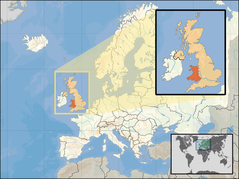
| వివరణ | Location of Wales in the UK and Europe, on terrain map showing surface and underwater contour areas. | |||
| తేదీ | ||||
| మూలం | Derived from Wikimedia Commons image of original work forming part of the "Europe location" map series created by David Liuzzo: derived from Image:Europe_location_WAL.png. | |||
| కర్త | uploaded by User:Kmusser (excerpt from User:David_Liuzzo) | |||
| అనుమతి (ఈ దస్త్రాన్ని పునర్వినియోగించుకోవడం) |
|
|||
| ఇతర కూర్పులు |
|


ఫైలు చరితం
తేదీ/సమయం ను నొక్కి ఆ సమయాన ఫైలు ఎలా ఉండేదో చూడవచ్చు.
| తేదీ/సమయం | నఖచిత్రం | కొలతలు | వాడుకరి | వ్యాఖ్య | |
|---|---|---|---|---|---|
| ప్రస్తుత | 17:20, 24 సెప్టెంబరు 2008 | | 1,600 × 1,200 (803 KB) | Kmusser | {{Information |Description= Location of Wales in the UK and Europe, on terrain map showing surface and underwater contour areas. |Source=Derived from Wikimedia Commons image of original work forming part of the "Europe location" map series cre |
లింకులు
ఈ ఫైలును వాడుతున్న పేజీలు లేవు.
సార్వత్రిక ఫైలు వాడుక
ఈ దస్త్రాన్ని ఈ క్రింది ఇతర వికీలు ఉపయోగిస్తున్నాయి:
- an.wikipedia.org లో వాడుక
- ar.wikipedia.org లో వాడుక
- az.wiktionary.org లో వాడుక
- el.wikivoyage.org లో వాడుక
- en.wikipedia.org లో వాడుక
- eu.wiktionary.org లో వాడుక
- fo.wikipedia.org లో వాడుక
- gag.wikipedia.org లో వాడుక
- gom.wikipedia.org లో వాడుక
- gv.wikipedia.org లో వాడుక
- id.wikibooks.org లో వాడుక
- incubator.wikimedia.org లో వాడుక
- kaa.wikipedia.org లో వాడుక
- kn.wikipedia.org లో వాడుక
- la.wikipedia.org లో వాడుక
- mr.wikipedia.org లో వాడుక
- my.wikipedia.org లో వాడుక
- nds-nl.wikipedia.org లో వాడుక
- pl.wikipedia.org లో వాడుక
- pl.wikivoyage.org లో వాడుక
- pl.wiktionary.org లో వాడుక
- pnb.wikipedia.org లో వాడుక
- ru.wiktionary.org లో వాడుక
- su.wikipedia.org లో వాడుక
- ug.wikipedia.org లో వాడుక
- war.wikipedia.org లో వాడుక
- yo.wikipedia.org లో వాడుక
- zu.wikipedia.org లో వాడుక