దస్త్రం:Field-Map birdie.jpg
ఈ మునుజూపు పరిమాణం: 561 × 599 పిక్సెళ్ళు. ఇతర రిజల్యూషన్లు: 225 × 240 పిక్సెళ్ళు | 449 × 480 పిక్సెళ్ళు | 719 × 768 పిక్సెళ్ళు | 959 × 1,024 పిక్సెళ్ళు | 1,918 × 2,048 పిక్సెళ్ళు | 2,592 × 2,768 పిక్సెళ్ళు.
అసలు దస్త్రం (2,592 × 2,768 పిక్సెళ్ళు, ఫైలు పరిమాణం: 2.76 MB, MIME రకం: image/jpeg)
This is a file from the Wikimedia Commons. Information from its description page there is shown below. Commons is a freely licensed media file repository. You can help. |
సారాంశం
| వివరణ |
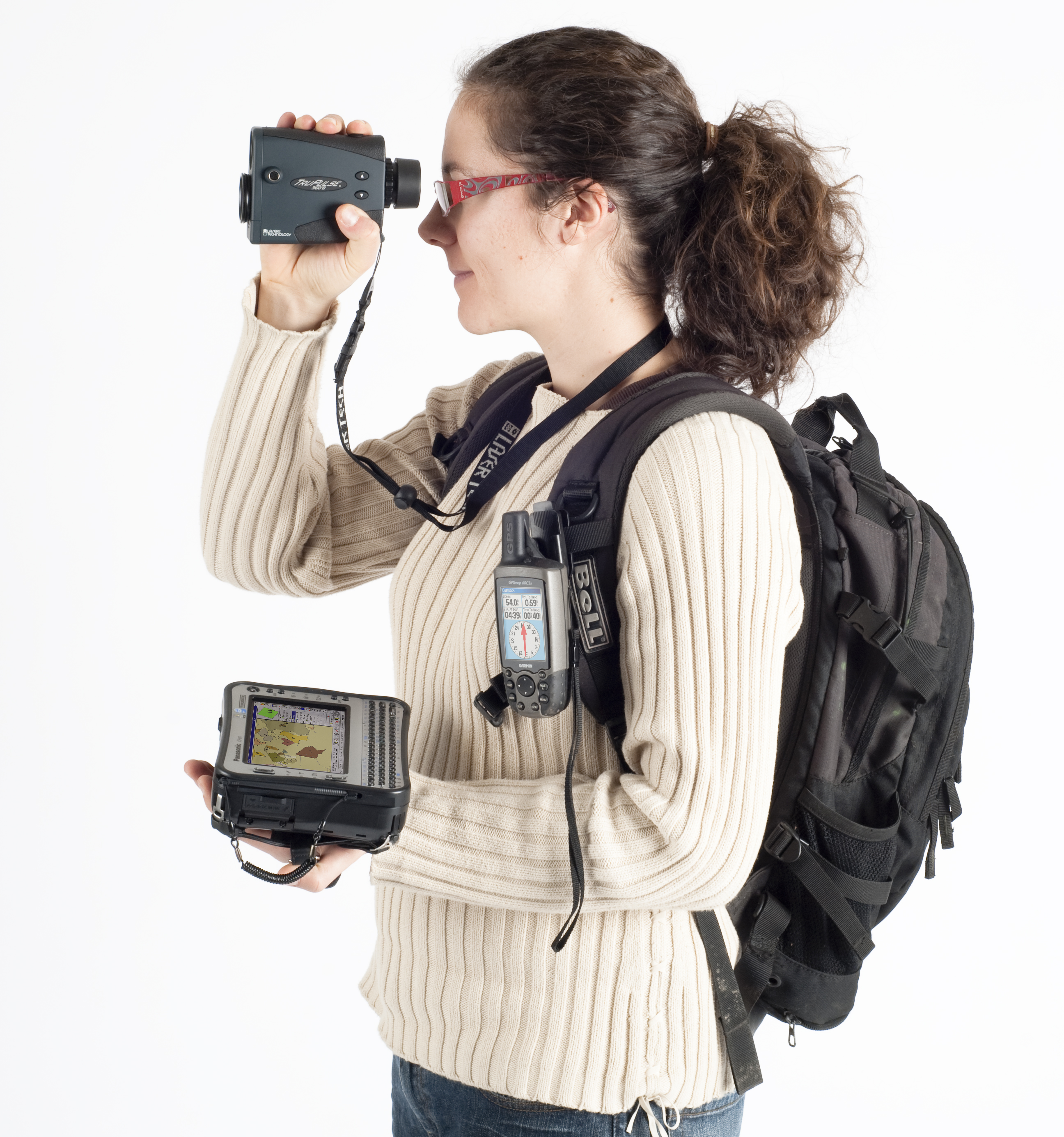
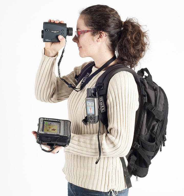
Français : Field-Map : Exemple de la technologie pour les inventaires forestiers (laser télémètre, inclinomètre, boussole électronique, GPS, ordinateur de terrain)
English: Field-Map : Example of hardware equipment for forest inventories: GPS and laser rangefinder for mapping connected to a field rugged computer. Čeština: Field-Map : Technologie pro inventarizace lesů a lesní taxaci (laserový dálkoměr, GPS, terénní počítač). |
| తేదీ | 3. 7. 2010 |
| మూలం | స్వంత కృతి |
| కర్త | Claudiusmm |
లైసెన్సింగ్
| నేను, ఈ కృతి యొక్క కాపీహక్కుదారుని, ఈ కృతిని సార్వజనీనం'గా విడుదల చేస్తున్నాను. ఇది ప్రపంచవ్యాప్తంగా వర్తిస్తుంది. కొన్ని దేశాల్లో ఇది చట్టబద్ధంగా సాధ్యంకాకపోవచ్చు; అయితే: ఈ కృతిని ఎటువంటి షరతులు లేకుండా, అట్టి షరతులు చట్టం వల్ల తప్పనిసరి అయితే తప్ప, ఏ ఉద్దేశానికైనా ఉపయోగించుకునే హక్కును ఎవరికైనా నేను ప్రదానం చేస్తున్నాను. |
ఫైలు చరితం
తేదీ/సమయం ను నొక్కి ఆ సమయాన ఫైలు ఎలా ఉండేదో చూడవచ్చు.
| తేదీ/సమయం | నఖచిత్రం | కొలతలు | వాడుకరి | వ్యాఖ్య | |
|---|---|---|---|---|---|
| ప్రస్తుత | 08:40, 3 జూలై 2010 | | 2,592 × 2,768 (2.76 MB) | Claudiusmm | {{Information |Description={{fr|1=Exemple de la technologie pour les inventaires forestiers (laser télémètre, in-clinomètre, boussole électronique, GPS, ordinateur de terrain) }} {{en|1=Hardware for forest inventories: laser range-finder, GPS, field- |
లింకులు
కింది పేజీలలో ఈ ఫైలుకు లింకులు ఉన్నాయి:
సార్వత్రిక ఫైలు వాడుక
ఈ దస్త్రాన్ని ఈ క్రింది ఇతర వికీలు ఉపయోగిస్తున్నాయి:
- ar.wikipedia.org లో వాడుక
- ca.wikipedia.org లో వాడుక
- en.wikipedia.org లో వాడుక
- es.wikipedia.org లో వాడుక
- et.wikipedia.org లో వాడుక
- fr.wikipedia.org లో వాడుక
- fr.wikiversity.org లో వాడుక
- gl.wikipedia.org లో వాడుక
- hr.wikipedia.org లో వాడుక
- id.wikipedia.org లో వాడుక
- it.wikipedia.org లో వాడుక
- ja.wikipedia.org లో వాడుక
- lt.wikipedia.org లో వాడుక
- nl.wikinews.org లో వాడుక
- no.wikipedia.org లో వాడుక
- uk.wikipedia.org లో వాడుక