దస్త్రం:India Andhra Pradesh locator map.svg

ఈ ఫైలు SVG కు చెందిన ఈ మునుజూపు PNG పరిమాణం: 542 × 599 పిక్సెళ్ళు. ఇతర రిజల్యూషన్లు: 217 × 240 పిక్సెళ్ళు | 434 × 480 పిక్సెళ్ళు | 695 × 768 పిక్సెళ్ళు | 927 × 1,024 పిక్సెళ్ళు | 1,853 × 2,048 పిక్సెళ్ళు | 580 × 641 పిక్సెళ్ళు.
అసలు దస్త్రం (SVG ఫైలు, నామమాత్రంగా 580 × 641 పిక్సెళ్ళు, ఫైలు పరిమాణం: 6.93 MB)
This is a file from the Wikimedia Commons. Information from its description page there is shown below. Commons is a freely licensed media file repository. You can help. |
| శీర్షిక |
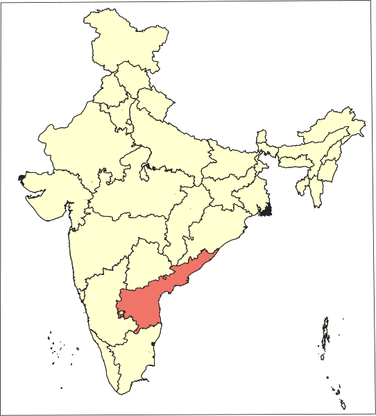
Andhra Pradesh locator map |
|||||||||
| Description |
Locator map of the state of Andhra Pradesh (post Telangana statehood and transfer of places impacted by Polavaram project), India. |
|||||||||
| తేదీ | ||||||||||
| మూలం |
స్వంత కృతి |
|||||||||
| స్రష్ట | ||||||||||
| అనుమతి (ఈ దస్త్రాన్ని పునర్వినియోగించుకోవడం) |
నేను, ఈ కృతి యొక్క కాపీహక్కుదారుని, దీన్ని ఈ లైసెన్సు క్రింద ఇందుమూలముగా ప్రచురిస్తున్నాను: This file is licensed under the Creative Commons Attribution-Share Alike 4.0 International license.
|
|||||||||
| Geotemporal data | ||||||||||
| Date depicted | ||||||||||
| Spatial reference system | conic (QGIS proj4 +proj=lcc +lat_1=35.172805555556 +lat_2=12.472944444 +lat_0=24 +lon_0=80 +x_0=0 +y_0=0 +datum=WGS84 +units=m +no_defs) | |||||||||
| Bounding box |
|
|||||||||
| Georeferencing | If inappropriate please set warp_status = skip to hide. | |||||||||
| Archival data | ||||||||||
| గమనికలు | Part of WikiProject India Maps | |||||||||

ఫైలు చరితం
తేదీ/సమయం ను నొక్కి ఆ సమయాన ఫైలు ఎలా ఉండేదో చూడవచ్చు.
| తేదీ/సమయం | నఖచిత్రం | కొలతలు | వాడుకరి | వ్యాఖ్య | |
|---|---|---|---|---|---|
| ప్రస్తుత | 12:05, 22 ఆగస్టు 2019 | | 580 × 641 (6.93 MB) | Arjunaraoc | Removed the border |
| 11:35, 22 ఆగస్టు 2019 |  | 635 × 680 (6.93 MB) | Arjunaraoc | {{Information |description ={{en|1=India Andhra Pradesh locator (2014-)}} {{te|1=భారతదేశం ఆంధ్రప్రదేశ్ సూచిక}} |date =2019-08-22 |source =Own creation based on SOI data |author =Arjunaraoc }} Category:India Category:Andhra Pradesh |
లింకులు
కింది పేజీలలో ఈ ఫైలుకు లింకులు ఉన్నాయి:
సార్వత్రిక ఫైలు వాడుక
ఈ దస్త్రాన్ని ఈ క్రింది ఇతర వికీలు ఉపయోగిస్తున్నాయి:
- en.wikipedia.org లో వాడుక
- en.wikinews.org లో వాడుక
- fa.wikipedia.org లో వాడుక
- gu.wikipedia.org లో వాడుక
- hi.wikipedia.org లో వాడుక
- ml.wikipedia.org లో వాడుక
- ms.wikipedia.org లో వాడుక
- pam.wikipedia.org లో వాడుక
- Banganapalle
- Bhimavaram
- Chittoor
- Kadapa
- Gudivada
- Guntur
- Hyderabad, India
- Jagtial
- Kakinada
- Karimnagar
- Khammam
- Kurnool
- Madanapalle
- Mahbubnagar
- Mangalagiri
- Machilipatnam
- Nalgonda
- Nandyal
- Narasaraopet
- Nellore
- Nizamabad, Andhra Pradesh
- Rajahmundry
- Rajampet
- Siddipet
- Srikakulam
- Tandur
- Tenali
- Tirumala - Tirupati
ఈ దస్త్రపు మరింత సార్వత్రిక వాడుకను చూడండి.