దస్త్రం:Map of Punjab from The Imperial Gazetteer of India (1907-1909).jpg
ఈ మునుజూపు పరిమాణం: 729 × 599 పిక్సెళ్ళు. ఇతర రిజల్యూషన్లు: 292 × 240 పిక్సెళ్ళు | 584 × 480 పిక్సెళ్ళు | 1,000 × 822 పిక్సెళ్ళు.
అసలు దస్త్రం (1,000 × 822 పిక్సెళ్ళు, ఫైలు పరిమాణం: 294 KB, MIME రకం: image/jpeg)
This is a file from the Wikimedia Commons. Information from its description page there is shown below. Commons is a freely licensed media file repository. You can help. |
.jpg)
సారాంశం
| వివరణ |
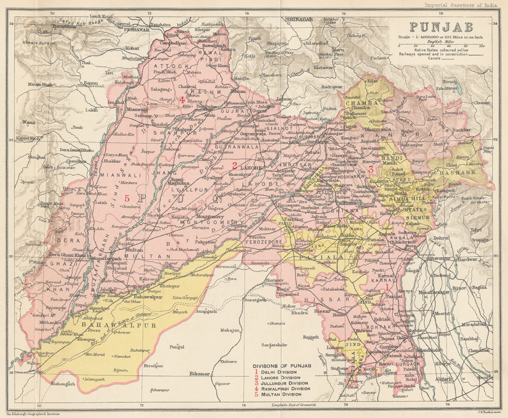
English: Map of Punjab from The Imperial Gazetteer of India Volume 20, opposite page 394. New edition, published under the authority of His Majesty's Secretary of State for India in Council. Oxford: Clarendon Press, 1907-1909.
Scale: 1:6,000,000. 1 in. to 94.6 miles. Divisions of the Punjab: 1. Delhi Division, 2. Lahore Division, 3. Jullundur Division, 4. Rawalpindi Division, 5. Multan Division. |
| తేదీ | ౧,౯౦౭.౦ - ౧,౯౦౯.౦ |
| మూలం | http://dsal.uchicago.edu/maps/gazetteer/index.html |
| కర్త | John G. Bartholomew |
లైసెన్సింగ్
The author died in 1920, so this work is in the public domain in its country of origin and other countries and areas where the copyright term is the author's life plus 100 years or fewer. | |
| This file has been identified as being free of known restrictions under copyright law, including all related and neighboring rights. | |
ఫైలు చరితం
తేదీ/సమయం ను నొక్కి ఆ సమయాన ఫైలు ఎలా ఉండేదో చూడవచ్చు.
| తేదీ/సమయం | నఖచిత్రం | కొలతలు | వాడుకరి | వ్యాఖ్య | |
|---|---|---|---|---|---|
| ప్రస్తుత | 06:19, 8 అక్టోబరు 2014 | | 1,000 × 822 (294 KB) | Co9man | User created page with UploadWizard |
లింకులు
కింది పేజీలలో ఈ ఫైలుకు లింకులు ఉన్నాయి:
.jpg)