దస్త్రం:Ontario 1718.jpg
ఈ మునుజూపు పరిమాణం: 800 × 395 పిక్సెళ్ళు. ఇతర రిజల్యూషన్లు: 320 × 158 పిక్సెళ్ళు | 640 × 316 పిక్సెళ్ళు | 1,201 × 593 పిక్సెళ్ళు.
అసలు దస్త్రం (1,201 × 593 పిక్సెళ్ళు, ఫైలు పరిమాణం: 449 KB, MIME రకం: image/jpeg)
This is a file from the Wikimedia Commons. Information from its description page there is shown below. Commons is a freely licensed media file repository. You can help. |
| వివరణ |
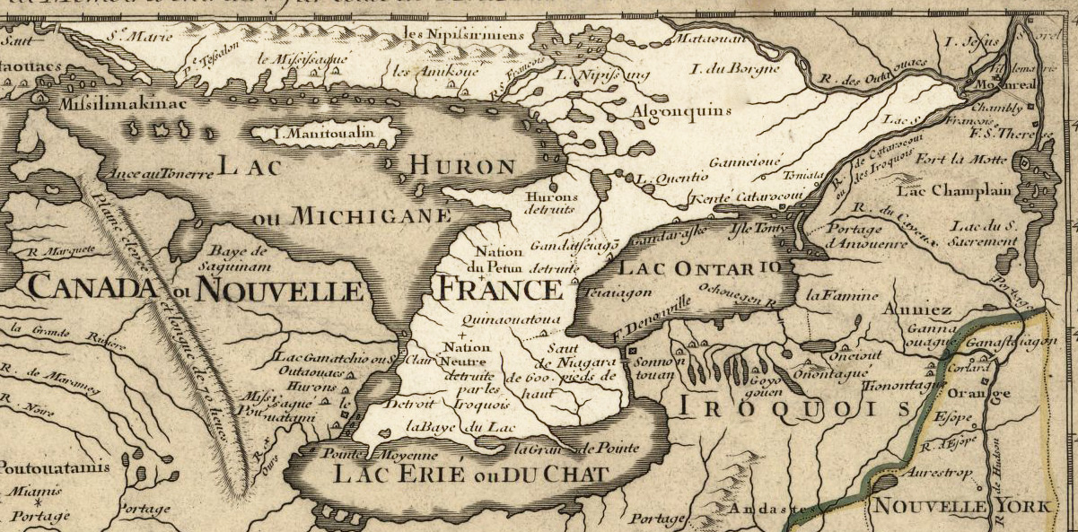
English: Ontario 1718, approximate modern province area highlighted, from Carte de la Louisiane et du cours du Mississipi by Guillaume de L'Isle. లైసెన్సింగ్My contributions cleaning and highlighting are donated to Public Domain. Bill Whittaker (talk) 19:32, 28 July 2009 (UTC) The Library of Congress scan is covered under: The original 1718 work is covered by: |
|||||||||||||||||||||||
| తేదీ | (mod. 2009) | |||||||||||||||||||||||
| మూలం | U.S. Library of Congress Public Domain Site: http://hdl.loc.gov/loc.gmd/g3700.ct000666 | |||||||||||||||||||||||
| కర్త |
|
|||||||||||||||||||||||
| అనుమతి (ఈ దస్త్రాన్ని పునర్వినియోగించుకోవడం) |
US Govt Public Domain, also author +100 years | |||||||||||||||||||||||

లైసెన్సింగ్
|
This work is in the public domain in its country of origin and other countries and areas where the copyright term is the author's life plus 100 years or fewer. | |
| This file has been identified as being free of known restrictions under copyright law, including all related and neighboring rights. | |
అసలు ఎక్కింపుల చిట్టా
The original description page was here. All following user names refer to en.wikipedia.
- 2009-07-28 19:31 Billwhittaker 1201×593× (459795 bytes) {{Information |Description = [[Ontario]] 1718, approximate modern province area highlighted, from ''Carte de la Louisiane et du cours du Mississipi'' by [[Guillaume de L'Isle]]. |Source = U.S. Library of Congress Public Domain Site: http://hd
ఫైలు చరితం
తేదీ/సమయం ను నొక్కి ఆ సమయాన ఫైలు ఎలా ఉండేదో చూడవచ్చు.
| తేదీ/సమయం | నఖచిత్రం | కొలతలు | వాడుకరి | వ్యాఖ్య | |
|---|---|---|---|---|---|
| ప్రస్తుత | 19:54, 21 సెప్టెంబరు 2009 | | 1,201 × 593 (449 KB) | Jeangagnon | {{Information |Description={{en|en:Ontario 1718, approximate modern province area highlighted, from ''Carte de la Louisiane et du cours du Mississipi'' by en:Guillaume de L'Isle.<br/> == Licensing: == My contributions cleaning and highlighting |
లింకులు
ఈ ఫైలును వాడుతున్న పేజీలు లేవు.
సార్వత్రిక ఫైలు వాడుక
ఈ దస్త్రాన్ని ఈ క్రింది ఇతర వికీలు ఉపయోగిస్తున్నాయి:
- de.wikipedia.org లో వాడుక
- en.wikipedia.org లో వాడుక
- fr.wikipedia.org లో వాడుక
- pt.wikipedia.org లో వాడుక