దస్త్రం:July 2011 Thailand Flooding.jpg

ఈ మునుజూపు పరిమాణం: 318 × 600 పిక్సెళ్ళు. ఇతర రిజల్యూషన్లు: 127 × 240 పిక్సెళ్ళు | 254 × 480 పిక్సెళ్ళు | 407 × 768 పిక్సెళ్ళు | 543 × 1,024 పిక్సెళ్ళు | 1,086 × 2,048 పిక్సెళ్ళు | 3,780 × 7,128 పిక్సెళ్ళు.
అసలు దస్త్రం (3,780 × 7,128 పిక్సెళ్ళు, ఫైలు పరిమాణం: 4.68 MB, MIME రకం: image/jpeg)
This is a file from the Wikimedia Commons. Information from its description page there is shown below. Commons is a freely licensed media file repository. You can help. |
సారాంశం
| వివరణ | |
| తేదీ | |
| మూలం | NASA Image of the Day |
| కర్త | NASA/GSFC/METI/ERSDAC/JAROS, and U.S./Japan ASTER Science Team |
| Camera location | | View this and other nearby images on: OpenStreetMap |
|---|
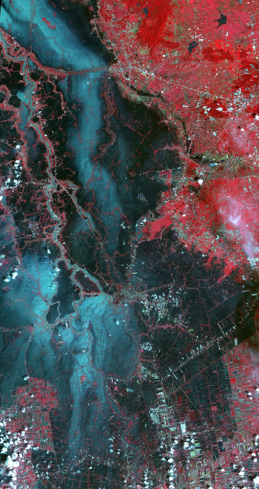
Image captured by the Advanced Spaceborne Thermal Emission and Reflection Radiometer instrument on NASA's Terra spacecraft.
లైసెన్సింగ్
| This file is in the public domain in the United States because it was solely created by NASA. NASA copyright policy states that "NASA material is not protected by copyright unless noted". (See Template:PD-USGov, NASA copyright policy page or JPL Image Use Policy.) | ||
 |
Warnings:
|
ఫైలు చరితం
తేదీ/సమయం ను నొక్కి ఆ సమయాన ఫైలు ఎలా ఉండేదో చూడవచ్చు.
| తేదీ/సమయం | నఖచిత్రం | కొలతలు | వాడుకరి | వ్యాఖ్య | |
|---|---|---|---|---|---|
| ప్రస్తుత | 15:15, 27 అక్టోబరు 2011 | | 3,780 × 7,128 (4.68 MB) | Originalwana | {{Information |Description ={{en|1=In this image, vegetation is displayed in red, and flooded areas are black and dark blue. Brighter blue shows sediment-laden water, and gray areas are houses, [[:Category:Build |
లింకులు
కింది పేజీలలో ఈ ఫైలుకు లింకులు ఉన్నాయి:
సార్వత్రిక ఫైలు వాడుక
ఈ దస్త్రాన్ని ఈ క్రింది ఇతర వికీలు ఉపయోగిస్తున్నాయి:
- ilo.wikipedia.org లో వాడుక
- incubator.wikimedia.org లో వాడుక
- ka.wikipedia.org లో వాడుక
- my.wikipedia.org లో వాడుక
- sh.wikipedia.org లో వాడుక