దస్త్రం:Egret all sky gamma ray map from CGRO spacecraft.png
మరింత స్పష్టమైన బొమ్మ లేదు.
Egret_all_sky_gamma_ray_map_from_CGRO_spacecraft.png (599 × 405 పిక్సెళ్ళు, ఫైలు పరిమాణం: 94 KB, MIME రకం: image/png)
This is a file from the Wikimedia Commons. Information from its description page there is shown below. Commons is a freely licensed media file repository. You can help. |
సారాంశం
| వివరణ |
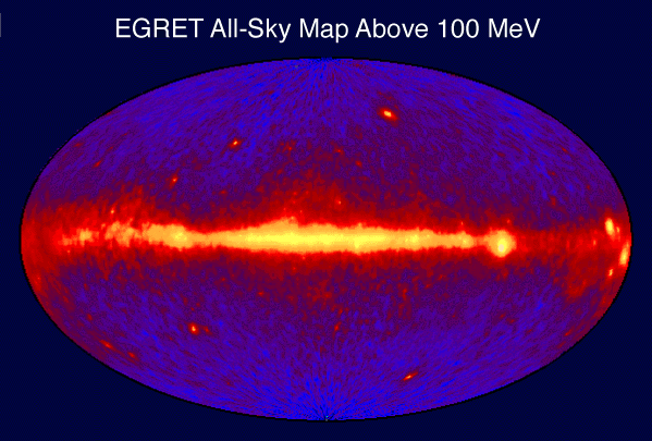
English: Egret all sky gamma ray (above 100MeV) map from CGRO spacecraft |
| మూలం | http://heasarc.nasa.gov/docs/cgro/images/epo/gallery/skymaps/sky_egret.gif (http://heasarc.nasa.gov/docs/cgro/images/epo/gallery/skymaps/index.html) |
| కర్త | NASA |
లైసెన్సింగ్
| This file is in the public domain in the United States because it was solely created by NASA. NASA copyright policy states that "NASA material is not protected by copyright unless noted". (See Template:PD-USGov, NASA copyright policy page or JPL Image Use Policy.) | ||
 |
Warnings:
|
అసలు ఎక్కింపుల చిట్టా
| తేదీ/సమయం | కొలతలు | వాడుకరి | వ్యాఖ్య |
|---|---|---|---|
| 21 డిసెంబరు 2011, 09:02:56 | 599 × 405 (78629 bytes) | Bulwersator (చర్చ · రచనలు) | {{Information |Description ={{en|1=Egret all sky gamma ray (above 100MeV) map from CGRO spacecraft}} |Source =http://heasarc.nasa.gov/docs/cgro/images/epo/gallery/skymaps/sky_egret.gif (http://heasarc.nasa.gov/docs/cgro/images/epo/gallery/skyma |
ఫైలు చరితం
తేదీ/సమయం ను నొక్కి ఆ సమయాన ఫైలు ఎలా ఉండేదో చూడవచ్చు.
| తేదీ/సమయం | నఖచిత్రం | కొలతలు | వాడుకరి | వ్యాఖ్య | |
|---|---|---|---|---|---|
| ప్రస్తుత | 03:20, 7 జనవరి 2015 | | 599 × 405 (94 KB) | GifTagger | Bot: Converting file to superior PNG file. (Source: Egret_all_sky_gamma_ray_map_from_CGRO_spacecraft.gif). This GIF was problematic due to non-greyscale color table. |
లింకులు
ఈ ఫైలును వాడుతున్న పేజీలు లేవు.
సార్వత్రిక ఫైలు వాడుక
ఈ దస్త్రాన్ని ఈ క్రింది ఇతర వికీలు ఉపయోగిస్తున్నాయి:
- da.wikipedia.org లో వాడుక
- el.wikipedia.org లో వాడుక
- en.wikipedia.org లో వాడుక
- en.wikibooks.org లో వాడుక
- it.wikipedia.org లో వాడుక
- ja.wikipedia.org లో వాడుక
- ko.wikipedia.org లో వాడుక
- ms.wikipedia.org లో వాడుక
- nl.wikipedia.org లో వాడుక
- ta.wikipedia.org లో వాడుక
- tr.wikipedia.org లో వాడుక
- uk.wikipedia.org లో వాడుక