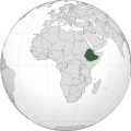
దస్త్రం:Ethiopia (Africa orthographic projection).svg

ఈ ఫైలు SVG కు చెందిన ఈ మునుజూపు PNG పరిమాణం: 550 × 550 పిక్సెళ్ళు. ఇతర రిజల్యూషన్లు: 240 × 240 పిక్సెళ్ళు | 480 × 480 పిక్సెళ్ళు | 768 × 768 పిక్సెళ్ళు | 1,024 × 1,024 పిక్సెళ్ళు | 2,048 × 2,048 పిక్సెళ్ళు.
అసలు దస్త్రం (SVG ఫైలు, నామమాత్రంగా 550 × 550 పిక్సెళ్ళు, ఫైలు పరిమాణం: 143 KB)
ఫైలు చరితం
తేదీ/సమయం ను నొక్కి ఆ సమయాన ఫైలు ఎలా ఉండేదో చూడవచ్చు.
| తేదీ/సమయం | నఖచిత్రం | కొలతలు | వాడుకరి | వ్యాఖ్య | |
|---|---|---|---|---|---|
| ప్రస్తుత | 09:42, 30 ఆగస్టు 2012 |  | 550 × 550 (143 KB) | Sémhur | Same with shadow |
| 09:40, 30 ఆగస్టు 2012 |  | 550 × 550 (143 KB) | Sémhur | Correcting few mistakes | |
| 10:28, 15 జూలై 2011 |  | 550 × 550 (134 KB) | Mixx321 | Sudan Południowy | |
| 11:34, 27 డిసెంబరు 2009 |  | 550 × 550 (132 KB) | Sémhur | == {{int:filedesc}} == {{Information |Description={{en|1=Orthographic map of Africa, showing Ethiopia location.}} {{fr|1=Carte orthographique de l'Afrique, montrant l'emplacement de l'Éthiopie.}} |Source=*[[:File:Africa |
లింకులు
ఈ ఫైలును వాడుతున్న పేజీలు లేవు.
సార్వత్రిక ఫైలు వాడుక
ఈ దస్త్రాన్ని ఈ క్రింది ఇతర వికీలు ఉపయోగిస్తున్నాయి:
- ady.wikipedia.org లో వాడుక
- am.wikipedia.org లో వాడుక
- am.wiktionary.org లో వాడుక
- ang.wikipedia.org లో వాడుక
- ann.wikipedia.org లో వాడుక
- arc.wikipedia.org లో వాడుక
- ar.wikipedia.org లో వాడుక
- ar.wiktionary.org లో వాడుక
- arz.wikipedia.org లో వాడుక
- avk.wikipedia.org లో వాడుక
- azb.wikipedia.org లో వాడుక
- az.wiktionary.org లో వాడుక
- ban.wikipedia.org లో వాడుక
- bbc.wikipedia.org లో వాడుక
- be-tarask.wikipedia.org లో వాడుక
- be.wikipedia.org లో వాడుక
- bew.wikipedia.org లో వాడుక
- bg.wikipedia.org లో వాడుక
- bh.wikipedia.org లో వాడుక
- bi.wikipedia.org లో వాడుక
- bm.wikipedia.org లో వాడుక
- btm.wikipedia.org లో వాడుక
- bxr.wikipedia.org లో వాడుక
- cdo.wikipedia.org లో వాడుక
- ceb.wikipedia.org లో వాడుక
- chr.wikipedia.org లో వాడుక
- ckb.wikipedia.org లో వాడుక
- cs.wikipedia.org లో వాడుక
- cu.wikipedia.org లో వాడుక
- dag.wikipedia.org లో వాడుక
- da.wikipedia.org లో వాడుక
- din.wikipedia.org లో వాడుక
- el.wikipedia.org లో వాడుక
- en.wikipedia.org లో వాడుక
- Rastafari
- Ethiopia
- List of companies of Ethiopia
- LGBTQ rights in Ethiopia
- History of the Jews in Ethiopia
- List of conflicts in Ethiopia
- User:Pharaoh Amun
- Wikipedia talk:Manual of Style/Pronunciation/Archive 9
- User:PMK2000/sandbox/Ethiopia
- User:JosephMohan/sandbox
- Wikipedia:Wikipedia Signpost/2019-10-31/On the bright side
- Wikipedia:Wikipedia Signpost/Single/2019-10-31
- User:BushelCandle/Ethiopia - stable lede
- User:BushelCandle/Template:Ethiopia
ఈ దస్త్రపు మరింత సార్వత్రిక వాడుకను చూడండి.