దస్త్రం:Insulae Capitis viridis-1598.jpg
ఈ మునుజూపు పరిమాణం: 800 × 570 పిక్సెళ్ళు. ఇతర రిజల్యూషన్లు: 320 × 228 పిక్సెళ్ళు | 640 × 456 పిక్సెళ్ళు | 1,024 × 729 పిక్సెళ్ళు | 1,280 × 911 పిక్సెళ్ళు | 1,438 × 1,024 పిక్సెళ్ళు.
అసలు దస్త్రం (1,438 × 1,024 పిక్సెళ్ళు, ఫైలు పరిమాణం: 318 KB, MIME రకం: image/jpeg)
This is a file from the Wikimedia Commons. Information from its description page there is shown below. Commons is a freely licensed media file repository. You can help. |
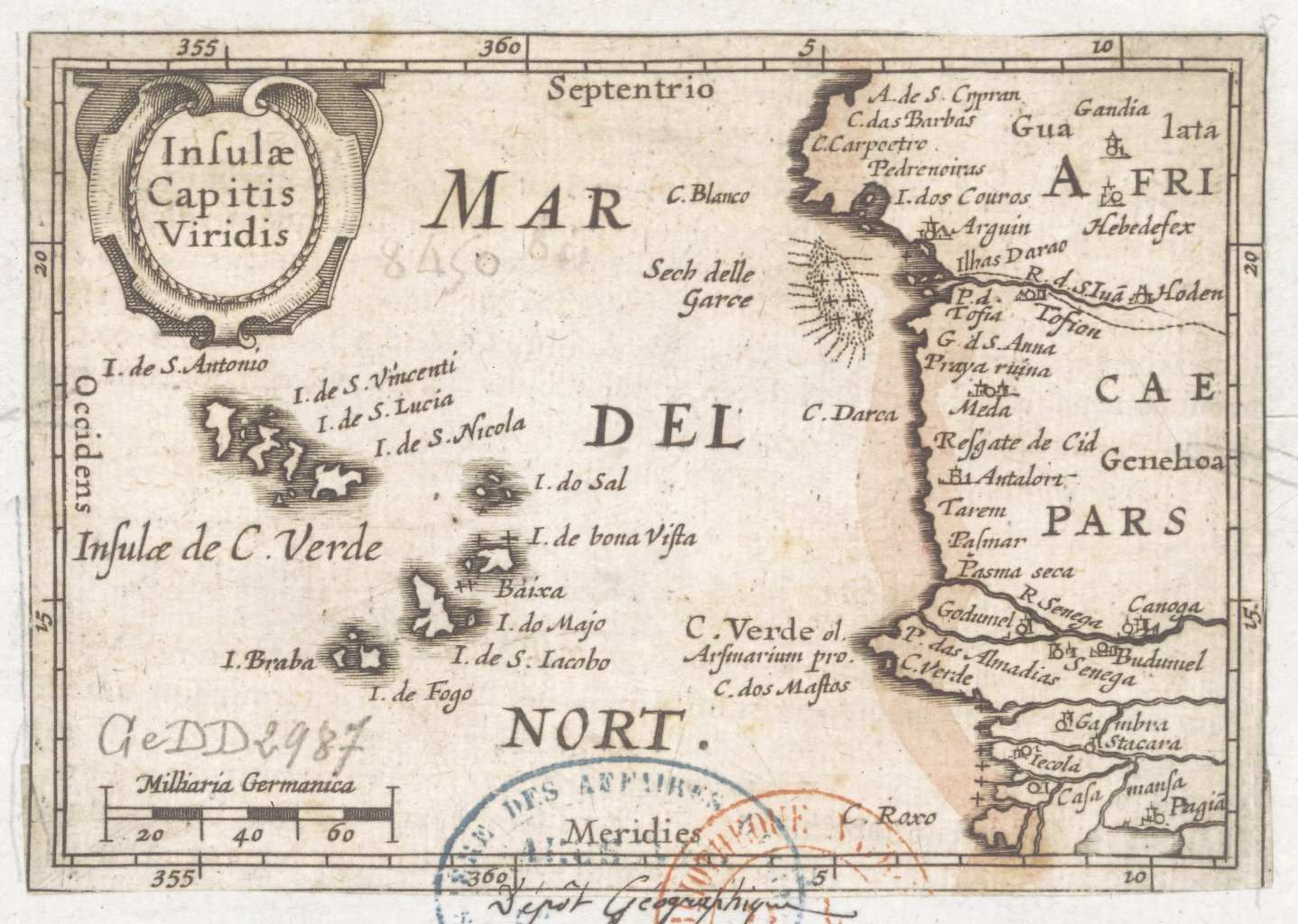
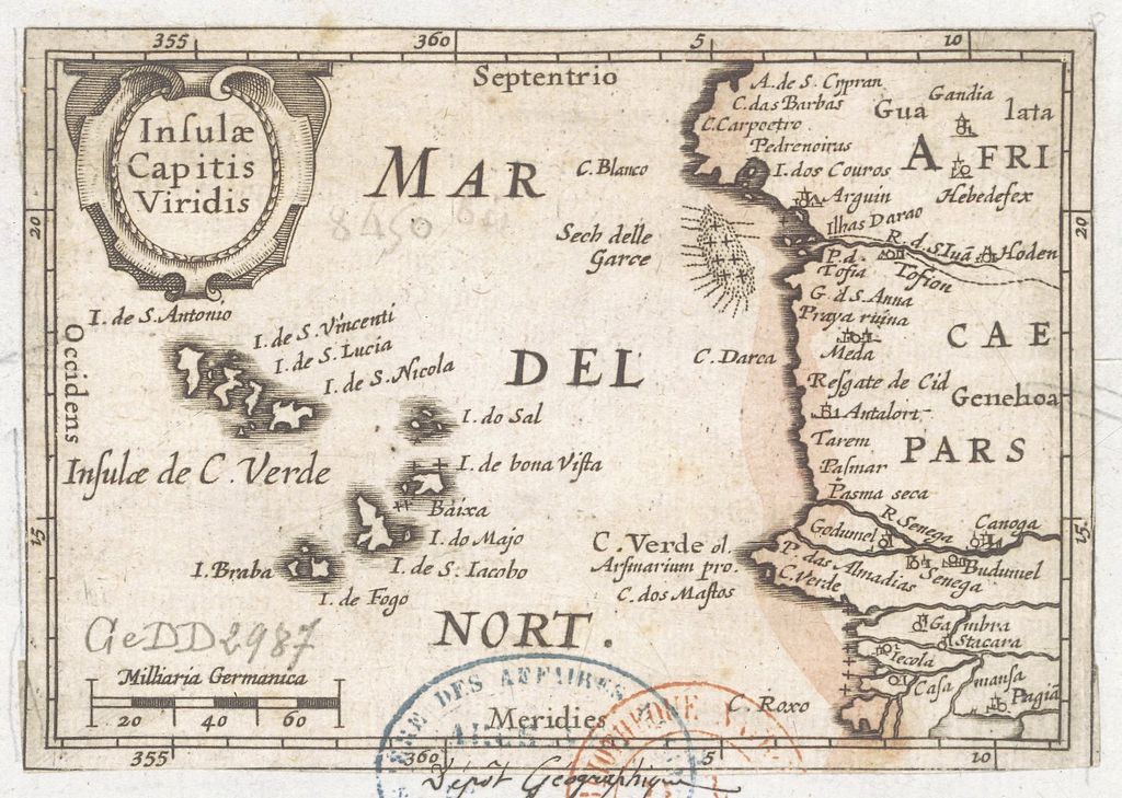
| వివరణ | Insulae Capitis viridis |
| తేదీ | |
| మూలం |
Bibliothèque nationale de France |
| కర్త | Langenes, Barent (15..-16..?). Cartographe |
| Previous public domain rationale, no longer applicable | ||
|---|---|---|
|
ఫైలు చరితం
తేదీ/సమయం ను నొక్కి ఆ సమయాన ఫైలు ఎలా ఉండేదో చూడవచ్చు.
| తేదీ/సమయం | నఖచిత్రం | కొలతలు | వాడుకరి | వ్యాఖ్య | |
|---|---|---|---|---|---|
| ప్రస్తుత | 08:01, 5 ఫిబ్రవరి 2013 | | 1,438 × 1,024 (318 KB) | Geagea | large |
| 07:20, 22 మార్చి 2010 |  | 719 × 542 (75 KB) | Ji-Elle | {{Information |Description=''Insulae Capitis viridis'' |Source=Gallica [http://gallica.bnf.fr/ark:/12148/btv1b7759743x] |Date=1598 |Author=Langenes, Barent (15..-16..?). Cartographe |Permission= |other_versions= }} [[Category:Maps made in the 16th centur |
లింకులు
కింది పేజీలలో ఈ ఫైలుకు లింకులు ఉన్నాయి:
సార్వత్రిక ఫైలు వాడుక
ఈ దస్త్రాన్ని ఈ క్రింది ఇతర వికీలు ఉపయోగిస్తున్నాయి:
- ca.wikipedia.org లో వాడుక
- en.wikipedia.org లో వాడుక
- es.wikipedia.org లో వాడుక
- fi.wikipedia.org లో వాడుక
- fr.wikipedia.org లో వాడుక
- id.wikipedia.org లో వాడుక
- io.wikipedia.org లో వాడుక
- ja.wikipedia.org లో వాడుక
- nl.wikipedia.org లో వాడుక
- no.wikipedia.org లో వాడుక
- sd.wikipedia.org లో వాడుక
- si.wikipedia.org లో వాడుక
- sv.wikipedia.org లో వాడుక