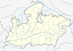
సిద్ది
మధ్య ప్రదేశ్ రాష్ట్రం లోని పట్టణం
సిద్ధి మధ్యప్రదేశ్ రాష్ట్రం, సిద్ధి జిల్లా లోని పట్టణం. ఇది జిల్లా ముఖ్యపట్టణం. పట్టణ పరిపాలనను పురపాలక సంఘం నిర్వహిస్తుంది.
సిద్ధి | |
|---|---|
పట్టణం | |
| Coordinates: 24°25′N 81°53′E / 24.42°N 81.88°E | |
| దేశం | |
| రాష్ట్రం | మధ్య ప్రదేశ్ |
| జిల్లా | సిద్ధి |
| Elevation | 272 మీ (892 అ.) |
| జనాభా (2011) | |
| • Total | 54,331 |
| భాషలు | |
| • అధికారిక | హిందీ |
| Time zone | UTC+5:30 (IST) |
| ISO 3166 code | IN-MP |
| Vehicle registration | MP-53 |
భౌగోళికం
మార్చుసిద్ధి 24°25′N 81°53′E / 24.42°N 81.88°E వద్ద, [1] సముద్ర మట్టం నుండి 272 మీటర్ల ఎత్తున ఉంది. ఒకప్పుడు ఇది, ఖజురాహోకు చెందిన చందేలా రాజ్పుత్రుల రాజ్యంలో భాగంగా ఉండేది.
రవాణా
మార్చుసిద్ధికి దగ్గరి విమానాశ్రయం 147 కిలోమీటర్ల (91 మైళ్ళు) దూరంలో ఉన్న ప్రయాగ్రాజ్లో ఉంది. దగ్గరి రైల్వే స్టేషన్లు మద్వాస్ (50 కి.మీ.) జోబా (60 కి.మీ.) వద్ద ఉన్నాయి.
జనాభా
మార్చు2001 భారత జనాభా లెక్కల ప్రకారం, [2] సిద్ధి జనాభా 45,664. అందులో పురుషులు జనాభాలో 54%, మహిళలు 46%. సిద్ధి అక్షరాస్యత 69%. ఇది జాతీయ సగటు 59.5% కంటే ఎక్కువ: పురుషుల అక్షరాస్యత 77%, స్త్రీల అక్షరాస్యత 60%. పట్తణ జనాభాలో 15% మంది 6 సంవత్సరాల కంటే తక్కువ వయస్సు గలవారు.
శీతోష్ణస్థితి
మార్చు| శీతోష్ణస్థితి డేటా - Sidhi (1981–2010, extremes 1958–2011) | |||||||||||||
|---|---|---|---|---|---|---|---|---|---|---|---|---|---|
| నెల | జన | ఫిబ్ర | మార్చి | ఏప్రి | మే | జూన్ | జూలై | ఆగ | సెప్టెం | అక్టో | నవం | డిసెం | సంవత్సరం |
| అత్యధిక రికార్డు °C (°F) | 32.8 (91.0) |
37.4 (99.3) |
42.2 (108.0) |
48.8 (119.8) |
46.6 (115.9) |
47.4 (117.3) |
43.2 (109.8) |
39.2 (102.6) |
39.0 (102.2) |
39.6 (103.3) |
36.4 (97.5) |
34.6 (94.3) |
48.8 (119.8) |
| సగటు అధిక °C (°F) | 24.6 (76.3) |
27.9 (82.2) |
33.5 (92.3) |
39.2 (102.6) |
41.9 (107.4) |
39.1 (102.4) |
33.5 (92.3) |
32.3 (90.1) |
32.6 (90.7) |
33.0 (91.4) |
29.9 (85.8) |
26.4 (79.5) |
32.8 (91.0) |
| సగటు అల్ప °C (°F) | 8.8 (47.8) |
11.5 (52.7) |
16.1 (61.0) |
21.9 (71.4) |
26.3 (79.3) |
27.6 (81.7) |
25.7 (78.3) |
25.2 (77.4) |
24.2 (75.6) |
19.9 (67.8) |
13.8 (56.8) |
9.1 (48.4) |
19.2 (66.6) |
| అత్యల్ప రికార్డు °C (°F) | 0.8 (33.4) |
2.0 (35.6) |
4.6 (40.3) |
11.8 (53.2) |
17.0 (62.6) |
20.0 (68.0) |
17.0 (62.6) |
17.4 (63.3) |
18.2 (64.8) |
12.0 (53.6) |
4.0 (39.2) |
1.0 (33.8) |
0.8 (33.4) |
| సగటు వర్షపాతం mm (inches) | 20.5 (0.81) |
22.7 (0.89) |
11.4 (0.45) |
7.3 (0.29) |
13.8 (0.54) |
117.2 (4.61) |
340.3 (13.40) |
316.8 (12.47) |
244.1 (9.61) |
35.2 (1.39) |
6.9 (0.27) |
7.1 (0.28) |
1,143.3 (45.01) |
| సగటు వర్షపాతపు రోజులు | 1.9 | 1.8 | 1.1 | 0.6 | 1.7 | 6.5 | 14.0 | 14.3 | 10.1 | 1.8 | 0.5 | 0.8 | 55.0 |
| సగటు సాపేక్ష ఆర్ద్రత (%) (at 17:30 IST) | 46 | 38 | 26 | 21 | 26 | 47 | 71 | 75 | 71 | 52 | 47 | 50 | 47 |
| Source: India Meteorological Department[3][4] | |||||||||||||
మూలాలు
మార్చు- ↑ Falling Rain Genomics, Inc - Sidhi
- ↑ "Census of India 2001: Data from the 2001 Census, including cities, villages and towns (Provisional)". Census Commission of India. Archived from the original on 2004-06-16. Retrieved 2008-11-01.
- ↑ "Station: Sidhi Climatological Table 1981–2010" (PDF). Climatological Normals 1981–2010. India Meteorological Department. January 2015. pp. 713–714. Archived from the original (PDF) on 5 February 2020. Retrieved 6 January 2021.
- ↑ "Extremes of Temperature & Rainfall for Indian Stations (Up to 2012)" (PDF). India Meteorological Department. December 2016. p. M132. Archived from the original (PDF) on 5 February 2020. Retrieved 6 January 2021.
