దస్త్రం:Interstate Highway plan March 30, 1970.jpg

ఈ మునుజూపు పరిమాణం: 800 × 531 పిక్సెళ్ళు. ఇతర రిజల్యూషన్లు: 320 × 212 పిక్సెళ్ళు | 640 × 425 పిక్సెళ్ళు | 1,024 × 679 పిక్సెళ్ళు | 1,280 × 849 పిక్సెళ్ళు | 1,818 × 1,206 పిక్సెళ్ళు.
అసలు దస్త్రం (1,818 × 1,206 పిక్సెళ్ళు, ఫైలు పరిమాణం: 152 KB, MIME రకం: image/jpeg)
This is a file from the Wikimedia Commons. Information from its description page there is shown below. Commons is a freely licensed media file repository. You can help. |
| వివరణ |
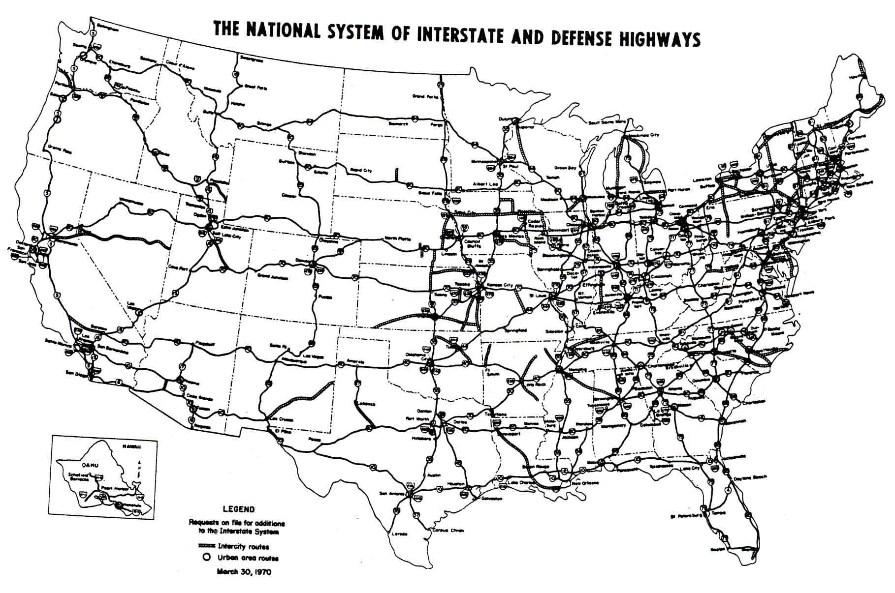
English: March 30, 1970, map of proposed additions to the Interstate Highway System; more information. |
| తేదీ | |
| మూలం |
This copy from kurumi.com. The original map was scanned from a different print copy of the following source digitized for Google Books:
|
| కర్త | Federal Highway Administration |
| అనుమతి (ఈ దస్త్రాన్ని పునర్వినియోగించుకోవడం) |
Public domain |
| This image is a work of a United States Department of Transportation employee, taken or made as part of that person's official duties. As a work of the U.S. federal government, the image is in the public domain. |
| Interstate Highway System planning maps | ||
|---|---|---|
| Ca. 1963 | March 30, 1970 | October 1, 1970 |
ఫైలు చరితం
తేదీ/సమయం ను నొక్కి ఆ సమయాన ఫైలు ఎలా ఉండేదో చూడవచ్చు.
| తేదీ/సమయం | నఖచిత్రం | కొలతలు | వాడుకరి | వ్యాఖ్య | |
|---|---|---|---|---|---|
| ప్రస్తుత | 07:09, 25 డిసెంబరు 2005 | | 1,818 × 1,206 (152 KB) | SPUI~commonswiki | {{PD-USGov}} March 30, 1970 map of proposed additions to the Interstate Highway System, from [http://www.kurumi.com/roads/3di/pics/map-isr-1970.jpg]. More information is at [http://www.kurumi.com/roads/3di/1970req.html]. [[Category:Interstate Highways|Map |
లింకులు
ఈ ఫైలును వాడుతున్న పేజీలు లేవు.