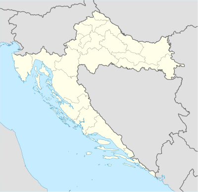
మూస:Location map Croatia
| name | Croatia | |||
|---|---|---|---|---|
| border coordinates | ||||
| 46.8 | ||||
| 13.1 | ←↕→ | 19.9 | ||
| 42.1 | ||||
| map center | 44°27′N 16°30′E / 44.45°N 16.5°E | |||
| image | Croatia_location_map.svg
| |||

| ||||
| skew | 1.0 | |||
| lat_skew | 0.0 | |||
Template:Location map Croatia is a location map definition used to overlay markers and labels on an equirectangular projection map of Croatia. The markers are placed by latitude and longitude coordinates on the default map or a similar map image.
Usage
మార్చుThese definitions are used by the following templates when invoked with parameter "Croatia":
{{Location map|Croatia |...}}{{Location map many|Croatia |...}}{{Location map+|Croatia |...}}{{Location map~|Croatia |...}}
Map definition
మార్చు- name
- used in default map caption (Croatia)
- image
- the default map image, without "Image:" or "File:" (Croatia_location_map.svg)
- top
- latitude at top edge of map, in decimal degrees (46.8)
- bottom
- latitude at bottom edge of map, in decimal degrees (42.1)
- left
- longitude at left edge of map, in decimal degrees (13.1)
- right
- longitude at right edge of map, in decimal degrees (19.9)
- skew
- skew to narrow longitudes (1.0)
- lat_skew
- skew to arc latitudes at edges (0.0)
Examples
మార్చుLocation map
మార్చు{{Location map | Croatia
| width = 250
| lat = 45.82
| long = 15.98
| label = Zagreb
}}
Location map many
మార్చుTwo locations in Croatia
{{Location map many | Croatia
| caption = Two locations in Croatia
| width   = 250
| lat     = 45.82
| long    = 15.98
| label   = Zagreb
| lat2    = 43.5
| long2   = 16.43
| label2  = Split
}}
Location map+
మార్చుTwo locations in Croatia
{{Location map+ | Croatia
| caption = Two locations in Croatia
| width   = 250
| places  =
  {{Location map~ | Croatia
  | lat   = 45.82
  | long  = 15.98
  | label = Zagreb
  }}
  {{Location map~ | Croatia
  | lat   = 43.5
  | long  = 16.43
  | label = Split
  }}
}}
