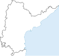
దస్త్రం:India Andhra Pradesh3 location map.svg

ఈ ఫైలు SVG కు చెందిన ఈ మునుజూపు PNG పరిమాణం: 380 × 362 పిక్సెళ్ళు. ఇతర రిజల్యూషన్లు: 252 × 240 పిక్సెళ్ళు | 504 × 480 పిక్సెళ్ళు | 806 × 768 పిక్సెళ్ళు | 1,075 × 1,024 పిక్సెళ్ళు | 2,150 × 2,048 పిక్సెళ్ళు.
అసలు దస్త్రం (SVG ఫైలు, నామమాత్రంగా 380 × 362 పిక్సెళ్ళు, ఫైలు పరిమాణం: 65 KB)
సారాంశం మార్చు
| Description |
ఆంధ్ర ప్రదేశ్ గుర్తింపు పటము (equirectangular projection for overlaying locations |
|---|---|
| Source |
స్వంత చిత్రం |
| Date |
2013-10-19 |
| Author |
Arjunaraoc |
| Permission (Reusing this file) |
క్రింద చూడండి |
| Additional information | Based on http://commons.wikimedia.org/wiki/File:India_location_map2.svg
Earlier Authors credit:Uwe Dedering at de.wikipedia derivative work: AshwiniKalantri |
లైసెన్సింగ్ మార్చు
I, the copyright holder of this work, hereby publish it under the following licenses:
You may select the license of your choice.
|
ఫైలు చరితం
తేదీ/సమయం ను నొక్కి ఆ సమయాన ఫైలు ఎలా ఉండేదో చూడవచ్చు.
| తేదీ/సమయం | నఖచిత్రం | కొలతలు | వాడుకరి | వ్యాఖ్య | |
|---|---|---|---|---|---|
| ప్రస్తుత | 08:59, 12 జూన్ 2012 |  | 380 × 362 (65 KB) | Arjunaraoc (చర్చ | రచనలు) | Added Yanam from the original map, but at an approximate location |
| 08:27, 12 జూన్ 2012 |  | 380 × 362 (64 KB) | Arjunaraoc (చర్చ | రచనలు) | Joined and fillled the outline | |
| 05:31, 12 జూన్ 2012 |  | 380 × 362 (51 KB) | Arjunaraoc (చర్చ | రచనలు) | Based on http://commons.wikimedia.org/wiki/File:India_location_map2.svg Earlier Authors credit:Uwe Dedering at de.wikipedia derivative work: AshwiniKalantri |
ఈ దస్త్రాన్ని మీరు తిరగరాయలేరు.
లింకులు
ఈ ఫైలును వాడుతున్న పేజీలు లేవు.
