మూస:Infobox racecourse/doc
| This is a documentation subpage for మూస:Infobox racecourse. It may contain usage information, categories and other content that is not part of the original మూస page. |
| This template uses Lua: |
Usage
మార్చు| [[File:{{{logo}}}|{{{logo_size}}}|alt={{{logo_alt}}}]] {{{logo_caption}}} | |
| [[File:{{{image}}}|{{{image_size}}}|alt={{{alt}}}]] {{{caption}}} | |
| స్థానం | {{{location}}} |
|---|---|
| అక్షాంశ రేఖాంశాలు | {{{coordinates}}} |
| యజమాని | {{{owner}}} |
| నిర్వహణ | {{{operator}}} |
| ప్రారంభం | {{{opened}}} |
| మూసివేత | {{{closed}}} |
| ఎంతమంది కూర్చోవచ్చు? | {{{capacity}}} |
| ప్రదర్శన తేది | {{{channel}}} |
| రేస్ రకం | {{{racetype}}} |
| కోర్స్ రకం | {{{coursetype}}} |
| ప్రముఖ రేస్లు | {{{notableraces}}} |
| లైవ్ రేస్ ప్రసార వాహిక | {{{handle}}} |
| హాజరు | {{{attendance}}} |
| అధికారిక వెబ్సైటు | |
{{Infobox racecourse
| name         = <!-- REQUIRED -->
| logo         =
| logo_size    =
| logo_alt     =
| logo_caption =
| image        =
| image_size   =
| alt          =
| caption      =
| location     = <!-- REQUIRED -->
| coordinates  = <!-- use {{Coord}} -->
| owner        =
| operator     =
| opened       =
| closed       =
| capacity     =
| channel      =
| racetype     =
| coursetype   =
| notableraces =
| handle       =
| attendance   =
| website      = <!-- http://example.com -->
}}
Example
మార్చు | |
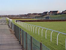
 The racecourse in 2006 | |
| స్థానం | Aintree, Merseyside, England |
|---|---|
| అక్షాంశ రేఖాంశాలు | 53°28′37″N 2°56′30″W / 53.47694°N 2.94167°W |
| యజమాని | Jockey Club Racecourses |
| ప్రారంభం | 7 July 1829 |
| ప్రదర్శన తేది | Racing UK |
| కోర్స్ రకం | National Hunt |
| ప్రముఖ రేస్లు | Grand National |
| అధికారిక వెబ్సైటు | |
{{Infobox racecourse
| name         = Aintree Racecourse
| logo         = Aintree Racecourse Logo.jpg
| image        = Aintree Racecourse in 2006.jpg
| caption      = The racecourse in 2006
| location     = [[Aintree]], [[Merseyside]], England
| coordinates  = {{coord|53|28|37|N|2|56|30|W|type:landmark_region:GB|display=inline,title}}
| owner        = [[Jockey Club]] Racecourses
| operator     =
| opened       = 7 July 1829
| closed       =
| capacity     =
| channel      = [[Racing UK]]
| racetype     =
| coursetype   = [[National Hunt]]
| notableraces = [[Grand National]]
| handle       =
| attendance   =
| website      = http://aintree.thejockeyclub.co.uk
}}
Microformat
మార్చుThe HTML markup produced by this template includes an hCard microformat, which makes the place-name and location parsable by computers, either acting automatically to catalogue articles across Wikipedia, or via a browser tool operated by a person, to (for example) add the subject to an address book. Within the hCard is a Geo microformat, which additionally makes the coordinates (latitude & longitude) parsable, so that they can be, say, looked up on a map, or downloaded to a GPS unit. For more information about the use of microformats on Wikipedia, please see the microformat project.
Sub-templates
మార్చుIf the place or venue has "established", "founded", "opened" or similar dates, use {{start date}} for the earliest of those dates unless the date is before 1583 CE.
If it has a URL, use {{URL}}.
Please do not remove instances of these sub-templates.
Classes
మార్చుhCard uses HTML classes including:
- adr
- agent
- category
- county-name
- extended-address
- fn
- label
- locality
- nickname
- note
- org
- region
- street-address
- uid
- url
- vcard
Geo is produced by calling {{coord}}, and uses HTML classes:
- geo
- latitude
- longitude
Please do not rename or remove these classes nor collapse nested elements which use them.
Precision
మార్చుWhen giving coordinates, please use an appropriate level of precision. Do not use {{coord}}'s |name= parameter.
Tracking category
మార్చు